|
|
WISE Release Coverage Service Help |
|
Enter a position or object name to determine which Wide-field Infrared Survey Explorer (WISE) Atlas Tile covers the specified location. This service also specifies if the Tile is included in the WISE AllWISE Data Release, All-Sky Data Release, 3-Band Cryo Data Release, and/or Preliminary Data Release. WISE observed each point on the sky in the 3.4, 4.6, 12 and 22 μm bands multiple times during its survey mission in 2010. Individual WISE exposures are combined in pre-defined 1.564°x1.564° footprints on the sky, known as Atlas Tiles, to form coadded Atlas Images and extracted Source Catalogs. The full sky is tessellated with 18,240 Atlas Tiles distributed in 119 iso-declination bands with 238 Tiles on the celestial equator and six Tiles in the |δ|=89.35° declination band. Tiles overlap by 180 arcsec in RA and Dec on the equator, and the RA overlap increases towards the equatorial poles. Note: This service does not cover data products from the NEOWISE Post-Cryo Mission (2010-2011), or from the NEOWISE Reactivation Mission (2013-), as these releases include only single-exposure image products, and no Atlas Tile image products. |
|
Input: The Coordinate/Object field combines in a single interface the name resolution look-up services of NED and SIMBAD as well as coordinate transformation services. The same input field is used for either name resolution or coordinate input and the service dynamically determines its content. IRSA accepts both decimal degree and sexagesimal inputs. If the input field contains a string which can be interpreted as a coordinate representation, it is used as such. If not, the string is sent first to NED, then to SIMBAD to attempt name resolution. The range of name formats acceptable is set by those projects. Coordinates entered into the interface allow for all information to be contained in a single string. The parser is very forgiving, so all of the following are valid (and give the results you would expect). For coordinate inputs, Equatorial J2000 is assumed unless specified otherwise.
Output: Best Tile: The identifier of the Tile in which the specified position/object is located. For positions that fall in Tile overlap regions, Best Tile is the one in which the position lies farthest from the Tile edge. Tile ID: Atlas Tile identifier that has the general form RRRRsDDD where RRRR is the Tile center Right Ascension in deci-degrees, truncated not rounded (e.g. RRRR=int(10*ra)), s is the Tile center declination sign ("p"="+", "m"="-") and DDD is the Tile center Declination, truncated for positive declinations and truncated leftward on the number line for negative declinations (e.g. DDD=ceil[10*abs(dec)]). RA, Dec: J2000 Right Ascension and Declination of the Tile center in decimal degrees. AllWISE Release, All-Sky Release, 3-Band Cryo Release, Preliminary Release: An "X" below any of these indicates that the Tile is included in the corresponding WISE data release. All tiles are included in the AllWISE and All-Sky releases, but only some Tiles are included in the other releases. |
|
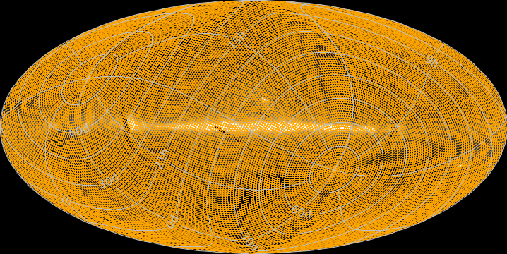
AllWISE Data Release: The WISE AllWISE Data Release, is comprised of all 18,240 Atlas Tiles that cover the full sky. The AllWISE Release includes all data taken during the full WISE mission, 7 January 2010 to 1 February 2011, including cryogenic and post-cryo mission phases, that were processed with improved calibrations and reduction algorithms. The diagram above shows the location of AllWISE Release Atlas Tiles on a galactic projection sky map, superimposed on the IRAS 100 μm map of the sky. Documentation on the AllWISE release can be found at: http://wise2.ipac.caltech.edu/docs/release/allwise . |
|
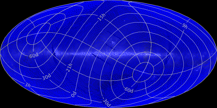
All-Sky Data Release: The WISE All-Sky Data Release, is comprised of all 18,240 Atlas Tiles that cover the full sky. The All-Sky Release includes all data taken during the full cryogenic mission phase, 7 January 2010 to 6 August 2010, that were processed with improved calibrations and reduction algorithms. The diagram above shows the location of All-Sky Release Atlas Tiles on a galactic projection sky map, superimposed on the IRAS 100 μm map of the sky. Documentation on the All-Sky release can be found at: http://wise2.ipac.caltech.edu/docs/release/allsky . |
|
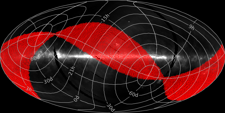
3-Band Cryo Data Release: The WISE 3-Band Cryo Data Release consists of 5,649 Tiles that cover approximately 31% of the sky. The 3-Band Cryo Release includes data taken between 6 August 2010 and 29 September 2010 following the exhaustion of solid Hydrogen in the WISE outer cryogen tank. During this time, the telescope and detectors were cooled by the inner cryogen tank and data were taken in the 3.4, 4.6 and 12 μm WISE bands. Documentation on the 3-Band Cryo Release can be found at: http://wise2.ipac.caltech.edu/docs/release/3band . |
|
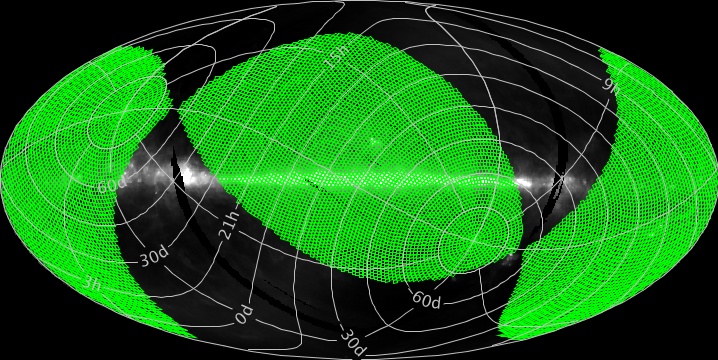
Preliminary Data Release: The April 2011 WISE Preliminary Data Release was comprised of 10,466 Atlas Tiles and covered approximately 57% of the sky. The Preliminary Release included data from the first 105 days of WISE survey observations, 14 January 2010 to 29 April 2010, that were processed with initial calibrations and reduction algorithms. The Preliminary Release products are superseded by those from the WISE All-Sky Release. Documentation on the Preliminary Release can be found at: http://wise2.ipac.caltech.edu/docs/release/prelim . |
|
|
Powered by the Virtual Astronomy Observatory (VAO) Inventory Service |