
Standard PACS photometric maps (Level 2, Level 2.5 and Level 3 products) are generated by the Standard Product Generator (SPG), stored into the Herschel Science Archive (HSA) and returned to the community for downloading. Among those, the so called Level 2.5 maps are generated by means of the JScanam and Unimap mapmakers, by combining scan observation with the associated cross-scan one. This operation increases the quality of the final maps with respect to the Level 2 maps, as it makes use of a larger data-set and exploits the capabilities of these two sophisticated mappers, designed for recovering the sky emission collected by PACS both from point like sources as well extended emissions.
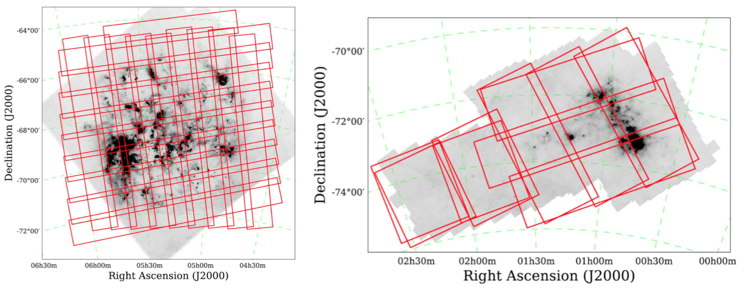
Nevertheless, there is a consistent number of observations (129 ObsIDs in Parallel Mode and 4452 ObsIDs in Scan Map mode) that don't satisfy the requirements for this combination into Level 2.5 products and they are processed by the SPG only up to Level 2. They are mostly spurious observations, where the sky areas are covered by other higher level maps (Level 2.5 or Level 3) but, in some cases, they are large maps that were acquired by using a scan strategy that prevents the generation of the standard Level 2.5 products. Among those there are the North and South Galactic Pole observations, acquired within the HATLAS observing programme, and the Magellanic Clouds (see e.g. above picture), acquired within the HERITAGE observing programme.
In order to increase the quality of the PACS legacy maps, the Unimap Highly Processed Data Product (HPDP) maps have been generated for large observations where the SPG was not capable to generate Level 2.5, or where spurious Level 2 observations exist, among higher level products of the same sky regions, that can be combined together to enhance the quality of the final maps.
The main purpose of these Highly Processed Data Products (HPDP) is to use the Unimap mapmaker on ObsIDs that are processed only up to Level 2 products by SPG, and increase the overall quality of the data over the considered sky regions. Unimap is a Generalised Least Square (GLS) mapmaker with sophisticated pre-processing modules designed for the PACS photometer and for combining any number of observations acquired for a certain sky region. The selected observations are all acquired in Parallel observing mode and they concern about 963 observing hours for 141 ObdIDs. Taking into account the total observing time in routine phase for Parallel AORs (6229 h in 754 AORs), the observations selected for the generation of Unimap HPDPs are just the 5% of Parallel obdIDs, but they involve a relevant fraction of observing time allocated for Parallel observations (15%).
The Unimap HPDP maps are served by the HSA, but alternatively they can be downloaded as individual files for each field and wavelength from this local Data repository, together with their Postcards. For each field and wavelength, one FITS file and one Unimap processing LOG file is made available, together with a postcard combining all available wavelengths. Within each FITS file, three separate extensions are combined, that contain respectively the scientific map in itself ('image'), the standard deviation or error map (called 'error', although this corresponds to the standard deviation map for products generated with Unimap version 6.3.3, and to the error map for product generated with Unimap version 6.4.2 and later -- see the 'mapper' FITS header parameter to check this) and the coverage map (called 'coverage'). Blue and Red (160 micron) images are provided for every field, except ELAIS S1, where only the 160 micron map was generated. All fields were acquired with the 100 micron filter in the Blue camera, except L1521 which was observed with the 70 micron filter. All the Unimap HPDP maps are from observations acquired in Parallel observing mode. Please see the Release Notes for further details.
Luca Calzoletti, David Teyssier (HSC), 11-July-2017
Modified by IRSA, 20-Nov-2017